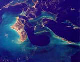
 Coastal
Ecology of the Bahamas
Coastal
Ecology of the BahamasPublications, Presentations, and Posters
Titles presented in blue are available for download in .pdf or .ppt form.
Publications:
Tools
and Methods for Studies in Coastal Ecology
Kathleen Sealey, editor
The Impact of Climate Change on The Bahamas
Neil Sealey
Coastal Erosion and Seawall Construction in The Bahamas
Neil Sealey
Peer-Reviewed Publications:
The 105th Christmas Bird Count (2007)
Sympatry of Grassquits on New Providence Island, Bahamas, Based on Analysis of CBC data
Anthony White, John Bjerke, Paul Dean, Kathleen Sealey
Caribbean Journal of Science (2007) 42(3)
Island-specific Responses of Bahamian Benthic Flora to Environmental Features
Vanessa L. Nero & Kathleen Sullivan Sealey
Abstract: We completed presence-absence surveys (n = 106) and point-intercept surveys (n = 79) of benthic flora (seagrasses, macroalgae, and cyanobacteria) around four major islands of The Bahamas to determine the effects of various environmental features on coastal benthic floral assemblage patterns. Assemblages were analyzed at the species, functional group, and phyla levels of analysis. Multivariate analyses indicated that wave energy, substrate, and island factors significantly affected the occurrence and abundance (proportional cover) of species and the abundance of functional groups. The abundances of different phyla were influenced by island and substrate, but the presence of the broader-scale functional groups or phyla were not significantly influenced by any factors considered. There were significant differences in the mean number of species observed at different levels of wave energy, substrate, and island, but not at different terrestrial vegetation covers or overall coastal impact ranks. Dominance plots revealed patterns in the contributions of species and functional groups at different levels of each factor. We observed no significant seasonal differences in floral assemblages, except for the increased abundance of the seagrass functional group in the summer. BIOENV analyses revealed a weak relationship between coastal terrestrial features (plant, land, and anthropogenic patterns) and the presence and abundance of benthic flora components, with overall terrestrial vegetation cover appearing to be the most influential of all terrestrial variables considered. Our study supports the use of morphologically-based functional groupings, and indicates that broader-level traits of flora species may explain observed distribution patterns.
Proceedings of the 10th International Coral Reef Symposium, Okinawa, Japan
Kathleen SEMON, Kathleen SULLIVAN-SEALEY, and Vanessa NERO
Abstract: Although stony corals are most frequently studied on high-relief reef structures, many coral species occur in a wide variety of nearshore tropical habitats, including mangrove creeks, seagrass beds and rocky platforms. This study estimated overall population size, potential reproductive output, and population structure for several species across sandy-bottom, hard-bottom, and patch reef habitats. The density of coral colonies, area of available habitat, and size distribution of colonies were recorded for several island bank systems in the central Bahamas. Size-frequency distributions were created for Siderastrea radians, Favia fragum, and Diploria clivosa in different habitats. Near shore patch reefs exhibited overall smaller population sizes and higher density of colonies, and contained more larger or older colonies. Near shore hard-bottom communities had larger population sizes and a lower density of colonies, and supported more small colonies, which may be either recruits or asexual clones. High numbers of larger colony sizes observed in dense patch reefs indicate a high sexual reproductive potential. A greater proportion of smaller individuals distributed widely across space in hard-bottom habitats indicate low sexually reproductive potential, and either high recruitment or high cloning rates.
Environmental Biology of Fishes (2006) 75:223-236
Fish-environment associations in the coastal waters of Andros Island, The Bahamas
Vanessa L. Nero & Kathleen Sullivan Sealey
Abstract: We surveyed fish communities and corresponding environmental
conditions at three broadly similar coastal sites of eastern Andros Island, The
Bahamas over a summer-winter-summer sequence to assess the relationship between
detailed environmental features and fish species patterns. Environmental
variables included covers of various benthic flora components, benthic flora
diversity, floral canopy height, micro-crustacean diversity and density, water
temperature, extent of destructive land-use and extent of invasion by
human-introduced exotic terrestrial plants. Correspondence analysis (CA)
indicated that spatial (site) differences in environmental characteristics were
greater than temporal (seasonal) differences. Detrended canonical
correspondence analysis (DCCA) was used to assess the strength of relationships
between the environmental characteristics and the distribution patterns of 25
fish species. Environmental features deemed to be most important in influencing
fish species patterns included benthic flora canopy height, extent
of invasion by exotic terrestrial plants, cover of Batophora oerstedii,
cover of Thalassia testudinum, turf cover, water temperature,
micro-crustacean
diversity, and micro-crustacean density. Based upon similarities in
distribution patterns, fish species formed four clusters which, ultimately,
reflected similarities in species’ feeding habits and preferences for habitats
that likely maximize foraging success. We conclude that fish distribution
patterns are related to environmental characteristics, and that anthropogenic
coastal activity, by influencing coastal benthic characteristics, may influence
the distribution and abundances of fish species in coastal habitats.
Environmental Biology of Fishes (2005) 73:437-444
Vanessa L. Nero & Kathleen Sullivan Sealey
Proceedings of the Andros Science Alliance (2005)
The state of the coast: report on Andros and South Andros
Kathleen Sullivan Sealey1, A. Lester Flowers2, Vanessa L. Nero1, Kathleen L. Semon1 and Keith Bradley3
1Department of Biology, University of Miami, Coral Gables, Fl 33124 USA
2 School of Natural Sciences, College of The Bahamas, P.O. Box N 4912, Nassau, Bahamas
3 Institute for Regional Conservation, 22601 SW 152 Ave, Miami, Fl 33170 USA
INTRODUCTION: Islands are, by their nature, only pieces of a larger whole. The past two decades have produced important research on island ecology in the tropical Atlantic that illustrates the integration of ecological function across land-sea boundaries, and the critical value of the coastal environments in stabilizing shorelines, processing pollutants, and supporting near shore production of important fisheries species. Unfortunately, islands of the wider Caribbean have been undergoing profound environmental change for over 500 years with human alterations of the coastal zone. A significant problem in the current development of coastal management policies and evaluation of environmental studies is the lack of synoptic method for the classification and ranking of human impacts for islands. This paper presents a method for characterization and assessment of the coastal zone in The Bahamas to address the status of Andros and South Andros Islands in terms of their ecological health.
final table of Andros and South Andros survey site rankings
Bahamas Journal of Science, 2005
Benthic marine plant patterns in coastal environments of The Bahamas: are all islands the same?
Vanessa Nero
Bahamas Journal of Science (2004)
Characterization and Ranking of Coastal Environments of the Bahamian Archipelago: a database for protection and policy (2004)
K. M. Sullivan Sealey, A. L. Flowers, V. L. Nero, K. L. Semon and J. Wilson. Bahamas Journal of Science 10:12-25
Abstract :Tropical islands present a particular challenge in balancing coastal development needs and environmental protection. A system of classification based on substrate, coastal vegetation communities and wave energy was combined with ranking human impacts on coasts for The Bahamas. The classification utilized a GIS land cover dataset, and resulting maps were used for landscape environmental studies as well as for community planning for national parks and development placement. Source human activities used in rankings included: 1.) Changes in coastal vegetations communities, 2.) Changes in coastal geomorphology and community structure from active physical restructuring or erosion, 3.) Dominance of invasive alien plant species, and 4) Density of buildings in the coastal zone. A convention for the rapid scoring of coastal impacts ranked segments of the shoreline as “low”, “medium”, “high” or “severely” impacted. Two islands, New Providence and Andros, are presents as examples.
Bulletin of Marine Science (2004)
Kathleen Sullivan Sealey
Abstract: The relationship between density of development and the health of near shore marine habitats is explored through spatial and temporal comparisons of patch reef environments in the central Bahamas. Near shore patch reefs are important fish habitats, and tend to have high, but variable, coral cover and benthic diversity in the Bahamian archipelago. Twelve patch reef stations were established off developed and undeveloped islands in the central Bahamas. Environmental parameters were measured over an 18-mo period to examine seasonal, tidal, and diurnal variability. Water quality measurements were not significantly different between developed and undeveloped sites for temperature, salinity, dissolved oxygen, chlorophyll-a, total nitrogen and total phosphorous. Only turbidity measurements were significantly different among sites, attributed to storm events. Ecological surveys recorded macroalgae species, stony coral species, coral cover, and coral vitality. Significant differences in species composition between developed and undeveloped stations were seen, with a higher coral diversity, lower coral cover, and higher incidence of coral lesions on developed patch reefs. A 53-yr comparison of near shore environments from aerial imagery showed significant loss of patch reefs and seagrass areas with increasing development density. Results stress the importance of comparison reefs in marine protected areas for evaluating impacts of coastal development on near shore marine habitats.
Proceedings from the World Tourism Congress (2001)
Aimee M. Lowe and Kathleen Sullivan Sealey
The Bahamas is a physically unique country unlike any other in the Caribbean; the archipelago is made up of hundreds of islands stretching over 1000 kilometers with over 30 inhabited islands. The country is subdivided into island groups, but the most populated island and location of the capital, Nassau, is in New Providence. The Bahamas represents one of the most popular tourist destinations in the wider Caribbean and entertains two tourist markets: 1) cruise ship and resort (overnight) tourism focused on the cities of Nassau and Freeport, and 2) out-island tourism that focuses on yachting, beach-going or fishing on the more remote islands. The Exuma Cays are located southeast of Nassau in the central Bahamas and are advertised as the "Sailing Capital of The Bahamas." Cruising yachts can pass through the Exumas en route to the wider Caribbean. This archipelago of low-lying islands is one of the most pristine and beautiful areas in the Bahamian island chain. The region offers numerous protected harbors and anchorages as well as one of the first marine fishing reserves, the Exuma Cays Land and Sea Park. The very success of the Park as a "no-take" zone has attracted an increasing number of visiting yachtsmen to the Exumas. This yearly increase in visitor numbers has stimulated local businesses to provide services and build infrastructure according to expediency rather than a concern for long-term environmental impacts. Now that symptoms of ecological degradation and tourism impacts are becoming visible within the developed areas of The Bahamas, there is a tremendous need to direct Exuma tourism to that which will sustain rather than destroy the environment, the very product marketed and sought. In order to gain accurate data on visitation patterns in the Exuma Cays and formulate recommendations for regional tourism monitoring and management, a visitor survey was conducted in Nassau, New Providence and throughout the Exuma island chain. Two methods were utilized to conduct the survey: 1) in-person interviews and 2) mail-out questionnaires. A total of 124 in-person and 560 mail-out questionnaires were completed over a one year period.
The survey questionnaire was divided into three sections in order to 1) characterize who visits the Exumas, 2) understand why they come, and 3) define what they are seeking. The data collected was then used to determine the impacts of tourism on the Park. For example, it was found that over half of Exuma tourists are first time visitors. Park management is faced with the task of educating these visitors as to the fishing regulations such as anchoring and garbage disposal. This requires time and staff support from a marine park that lacks specific plans and adequate financial backing. It is clear now important for the Park to create a clear management plan, a strategy for financing park activities in the future and new regulations to preserve the natural resources upon which both fishing stocks and visitation are dependent.
Manuscripts submitted for publication:
Fishery Bulletin (In Review)
Spatio-temporal patterns of size-frequency distributions
and size-specific habitat preferences of bonefish, Albula vulpes, in coastal
waters of Andros
Island, The Bahamas
Vanessa L. Nero & Kathleen Sullivan Sealey
Abstract: We examined the relationship between the
distribution patterns of bonefish, Albula vulpes, and the benthic
characteristics of the coastal habitats from which the bonefish were collected.
We sought to identify habitat use patterns of bonefish over three seasons of
sampling and to determine if these patterns were
size-related. Size-frequency distributions differed significantly at various
sites, tidal states, times of day, seasons, and sample sequences. Larger
individuals ( >250mm TL) were collected at only one of the four sites sampled,
and were more typically observed at high tide, winter, and morning seines.
Young-of-the-year (YOY) were characteristic of the three other sites, and were
more typically observed at low tide, summer, and afternoon seines. Benthic
characteristics were closely related to bonefish patterns, with YOY and non-YOY
individuals associating with very different habitat features. YOY were
associated with high algal cover (of various mid- to low-lying species) and
higher densities of amphipods, penaeid shrimp, and diogenid crabs; larger
bonefish were associated with sparser yet taller vegetation and high densities
of palicid and xanthid crabs and alpheid shrimps. Associations with crustacean
taxa correspond to age-related feeding habits documented by past studies. An
ontogenetic habitat shift is evident in these bonefish, with size-related
differences in habitat use most likely reflecting shifts in priorities for food
and refuge resources. This work suggests that bonefish distributions may be
influenced by some basic spatio-temporal factors, as well as by specific benthic
habitat qualities. By better understanding the relationship between
bonefish and their environment, we can make better management decisions aimed at
maintaining healthy populations of this economically-valuable species.
Manuscripts in Preparation:
Spatial-temporal patterns of
mangrove creek habitats in the Bahamian archipelago: a characterization as
related to size, energetics and feeding mode of tropical coastal fishes
Kathleen Sullivan Sealey, Vanessa Nero and Sherry Constantine
Abstract: We examine the benthic and oceanographic characteristics of
small mangrove creek systems with adjacent soft-bottom embayments in the
northern and central Bahamas to understand differences in the diversity and
biomass of fishes. Fish assemblages were evaluated by
standard beach seines, visual surveys and traps. Key species such as bonefish (Albula
vulpes), snappers (Family Lutjanidae) and mojarras
(Family Gerridae) vary in their abundance, size-frequency distribution and
abundance based on season, tidal state and habitat (site).
Benthic characteristics focused on floral (e.g. algae and seagrass) species
composition, density and canopy height, Habitat maps of three
different islands are used to first characterize mangrove systems by size,
variability in temperature and salinity, geomorphology as well
as proximity to platform margin reefs. Associations of fishes with particular
habitat and oceanographic features can be crucial to
monitoring population dynamics of commercially important species. The use of
more detailed mangrove creek habitat-complex characterization
can improve Marine Protected Area (MPA) planning.
Conference Presentations and Posters:
Invasive Species Control Efforts in The Bahamas
San Salvador Geology Symposium
Coastal Erosion Around San Salvador, Bahamas: A Field Trip Guide.
Neil Sealey and John McIroie
Abaco Science Alliance meeting, January 2004, Poster
The Effects of Coastal Development on Near shore Faunal Communities of the Bahamas
Kathleen Semon, Vanessa Nero, and Kathleen Sullivan Sealey
Abstract: The Earthwatch-sponsored ‘Coastal Ecology of the Bahamas’ Expedition has enjoyed two successful summer expeditions in Eleuthera and Andros. The Earthwatch team, which consists of staff members and a total of nearly 100 volunteers, surveyed coastal environments throughout both islands in order to study the effects of coastal development on coastal and marine organisms. Overall, the research objectives of the entire project are:
1: To ground-truth maps of coastal segments generated by LandSat 7 imagery and ancillary datasets on the Bahamas. A classified LandSat image for Andros was used to test remote sensing techniques in identifying coastal landscapes. Each color on the maps represents a different landcover class. For a more detailed explanation of the vegetation classification and marine benthic community classification, see the website “Atlas of Bahamian Environments” at http://islands.bio.miami.edu
2: To complete an assessment of altered coastal environments for potential sources of environmental degradation. Some areas of the coastline are mapped as “altered” with visible settlements or marinas. However, from satellite imagery, it is difficult to know how the historic coastline was changed. Areas need to be re-visited, and coastal alterations evaluated.
3: To complete shore profiles, and marine transect surveys for each distinct coastal segment. We needed to collect some quantitative data on the coastal zone characteristics above and below the water. Within the coastal segments, randomly selected points (using a stratified random sampling design) were surveyed. The coastal survey will have a land and sea component. The sea component will focus on distribution and abundance information on macroalgae, seagrasses and associated fauna.
4: To establish baseline information on the altered coastal segments of Andros Island, and begin planning for ecological restoration and long-term stabilization of the coastline. This last objective is the critical application of scientific information to management and restoration. Once we have mapped the coastal segments, and understand how near shore marine communities have changed, are there strategies that must be developed to restore altered coastal zones
This poster focuses on epifauna, and highlights some of the findings pertaining to Objective 3. Epifauna are the conspicuous animals that live on the seafloor, and include conch, spiny lobster, seastars, and corals. These organisms are sensitive to environmental change, and some species can be good indicators of the health of a given habitat. The epifauna composition of unaltered and altered shorelines are compared in order to determine if and how coastal development affects nearshore marine life.
Gulf and Coastal Fisheries Institute (GCFI), November 2004, Presentation and Manuscript
univariate and multivariate assessment of the RELATIONSHIPS BETWEEN macroALGAe/seagrass assemblages AND FISH ASSEMBLAGES IN COASTAL MARINE HABITATS OF THE BAHAMAS
Vanessa L. Nero and Kathleen Sullivan-Sealey
Abstract: Because of their potential abilities to provide critical high-quality resources to inhabitants, nearshore marine habitats have long been acknowledged as being superior habitats for newly settled larvae and juvenile fishes. In such coastal habitats, many of the desired critical resources, including food supply, refuge from predators, and protection from wave energy, are provided directly and/or indirectly by the assemblage of seagrass and macroalgae. Thus, it was hypothesized that a given site’s macroalgae/seagrass assemblage, (which helps determine the quality of the resources provided to larval and juvenile fish), will influence the structure of the fish assemblage utilizing that site. This study applied univariate and multivariate statistical analyses to determine which features of the macroalgae/seagrass assemblage most influence the structure of coastal fish assemblages in the Bahamas. Information about the algae assemblages at each of six study sites was obtained using point intercept analyses, species inventories, and canopy height measurements. Intensive beach seining across tidal stages, times of day, and seasons (to control for natural temporal variation in fish assemblages) was used to obtain estimates of fish abundance and diversity at each site. Univariate analyses, which included diversity measures and regression analyses, determined the nature of relationships between various features of the algae/seagrass assemblage (diversity, mean canopy height, percent benthic coverage) and features of the fish assemblage (diversity, abundance, mean size). Multivariate analyses, through the PRIMER statistical package, were used to determine which specific species and/or functional groups of macroalgae and seagrass were most responsible for the observed differences in fish assemblages at each of the study sites, and also to determine if particular species/functional groups of algae attracted particular species, families, or trophic groups of fish.
International Coral Reef Symposium (ICRS) meeting, July 2004, Poster
Complex systems and multivariate analysis of marine flora and fish assemblages in nearshore habitats: Examining the linkages between land use change and coral reef ecology
Vanessa NERO, Kathleen SULLIVAN-SEALEY, and Kathleen SEMON
Abstract: Coral reefs are recognized as complex systems that often defy simple descriptions in terms of scale and function. Reef fish assemblages represent one element of coral reef systems, but many fishes move daily, seasonally, or ontogenetically. The study of fish assemblages can help elucidate temporal and spatial scales of interactions across habitats. A multi-year study was undertaken to develop a landscape-scale model to characterize and assess the quality of a complex system of nearshore fish habitats in the Central Bahamas. Land cover and benthic habitat maps were combined with field studies to define relationships between key environmental elements, such as coastal geomorphology, wave energy and coastal vegetation structure to characterize nearshore fish habitats at eight study sites. Species assemblages of fish and macroalgae provide a strong characterization of habitat type and shore-specific changes with human alterations of the coastal zone. Changes in benthic macro-algae species occurrence help explain variability in fish diversity. The patterns of marine flora and fish species occurrences are sensitive to changes in coastal land use. Documentation of their occurrence patterns can be a powerful tool for characterization of coastal habitats based on remote sensing classifications.
Coalition for Excellence in Tropical Biology (CeTroB), September 2002, Poster
Characterization of nearshore marine communities off undeveloped shorelines: The influence of shoreline features on macroalgae-seagrass community structure
Vanessa NERO, Lester FLOWERS, Daniel LOEWENHERZ, Kathleen SULLIVAN SEALEY
Abstract: The first season of the 5-year Earthwatch project,‘Coastal Ecology of the Bahamas’, was successfully completed June through August 2002 in Eleuthera, Bahamas. This project integrates ecological assessment of marine, intertidal, and terrestrial habitats. The objectives are to:1)characterize coastal communities, and 2) quantify the impact of coastal development on ecological community structure, particularly abundance and diversity of vascular plants and algae. Nearshore macroalgae-seagrass environments provide essential habitat for many juvenile fishes and invertebrates, such as spiny lobsters, crabs, mollusks, and echinoderms. It is important to characterize these habitats and identify the environmental factors affecting them. Over 600 species of macro-algae and 3 species of seagrass occur in the wider Caribbean; macro-algae have been classified into “functional groups based on shape, morphology, and canopy coverage. Characterization of 50 different shoreline sites was carried out using 3 methods: i) Visual surveys of macro-algae diversity and abundance; ii) Point-intercept surveys to quantify coverage classes of biotic (e.g. macro-algae, seagrass, coral, octocoral, and sponge) and abiotic (e.g. rubble, sand, mud, and hardbar) components; and iii) Macro-algae Biomass measurements within quadrats. The coastal environment of each survey site was classified by describing its substrate (consolidated or sand) and energy regime (high or low). A basic characterization of the nearshore communities adjacent to undeveloped shorelines reveals how each shoreline feature (substrate type or energy regime) determines nearshore macro-algae community structure. Energy regime is a significant determinant of overall species diversity and functional group diversity, but not of percent cover of various benthic components or floral biomass. Substrate type did not have significant effects on biomass, percent cover of benthic components, or biomass measurements.
Coastal
Ecology of the Bahamas